This is our top-rated family hike! The Stagecoach Trail is an out-and-back hike that takes you from the pine and cedar forest to the shady Consumnes River in the canyon below. It is about 5 miles round trip, with about 700 ft of elevation change, and the best part is you can start from the front door of Gold Creek Cabin! Although the trail itself is well-marked and maintained, the trailhead can be hard to find, so follow along here and we’ll show you exactly what you need to know!
Be sure to pack:
Sunscreen
Bug spray
Lots of water
Picnic lunch
Downloaded or printed guide/map (no cellular service in the canyon)
The trail is very lightly traveled, perhaps due to being hard to find for some. You'll very likely have the trail to yourself, but be prepared to share the space with other hikers, dogs, horses, mountain bikes and dirt bikes.
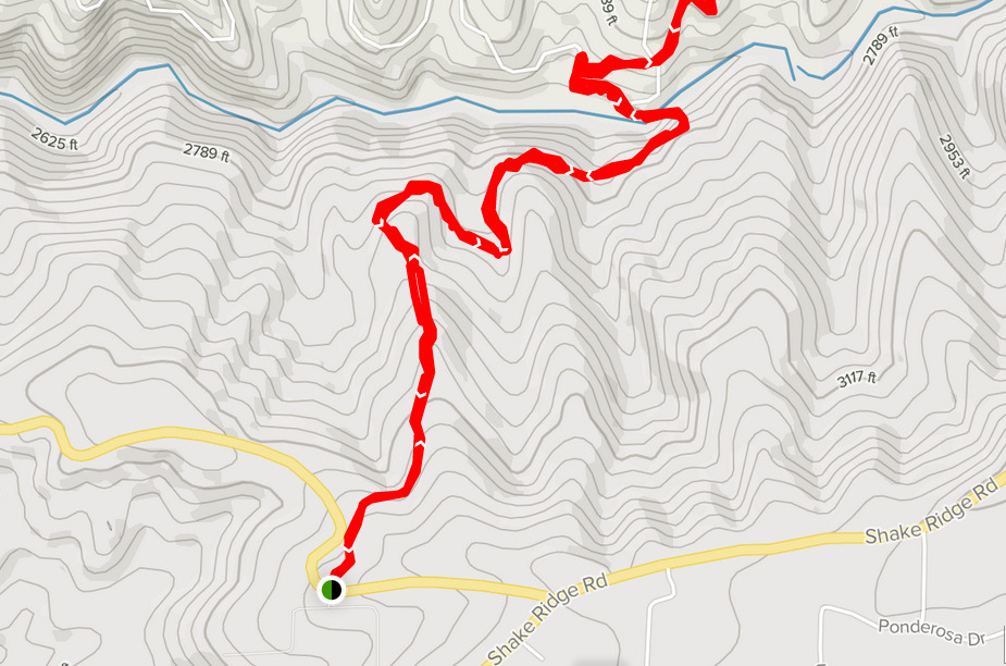
From the cabin, head out to Shake Ridge Road. Turn left onto Shake Ridge Road, and look for the road veering off to the right. This is Fiddletown Road; follow this and head down Fiddletown Road.
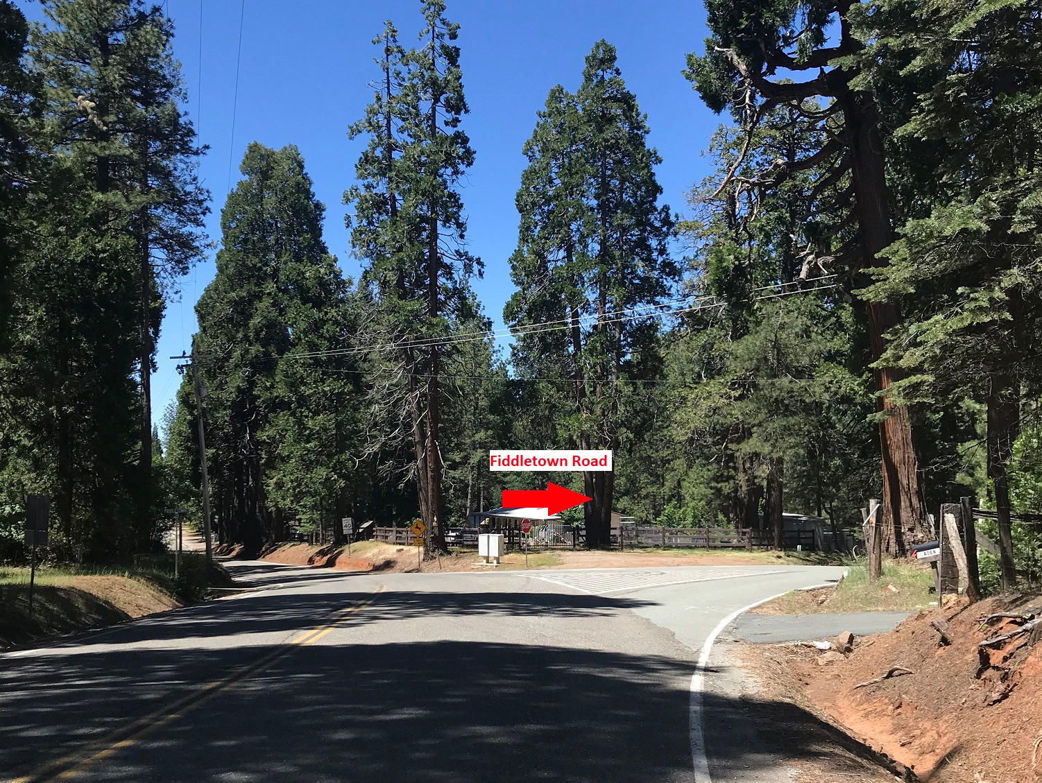
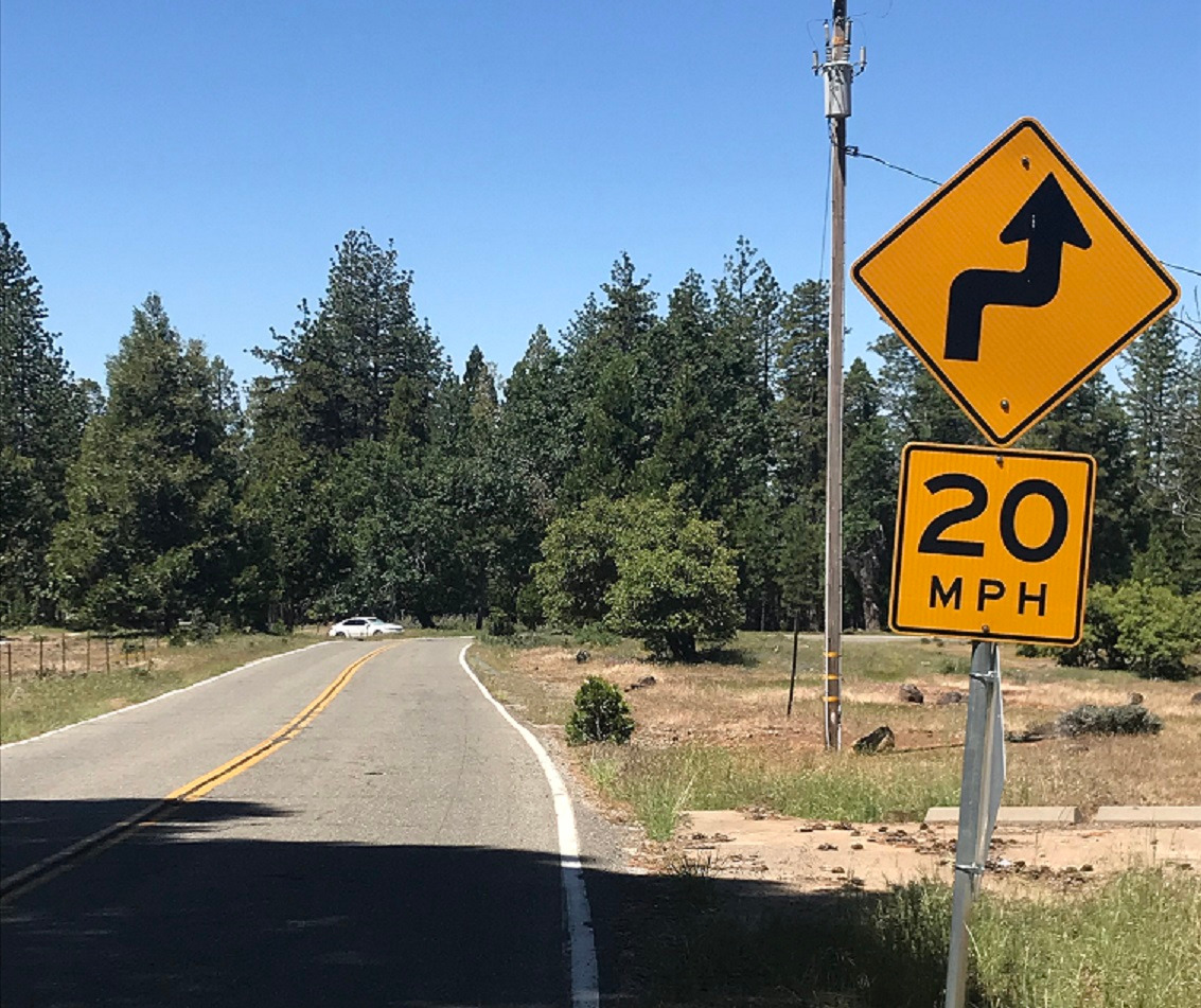
About a quarter of a mile down, you'll see a road sign indicating curves ahead. The trailhead is at the first curve. In the picture below, note the white car which is actually parked opposite the trailhead. (Note: if you prefer, you can drive to the trailhead and park in this small parking area. It is about one mile from the cabin to the trailhead.)
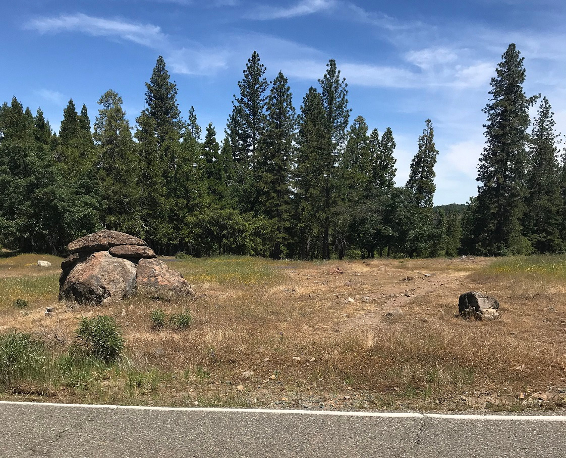
Once you arrive at that first curve, you'll see these rocks on the right-hand (north) side of Fiddletown Road. Enter here for the trailhead!
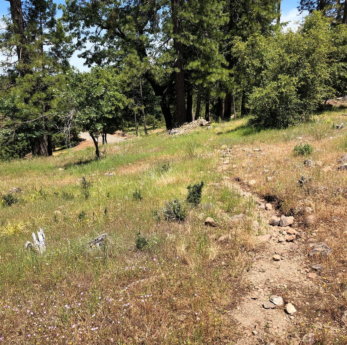
Head toward the trees where the trail becomes less trampled and better defined. Fiddletown Road ambles away on your left.
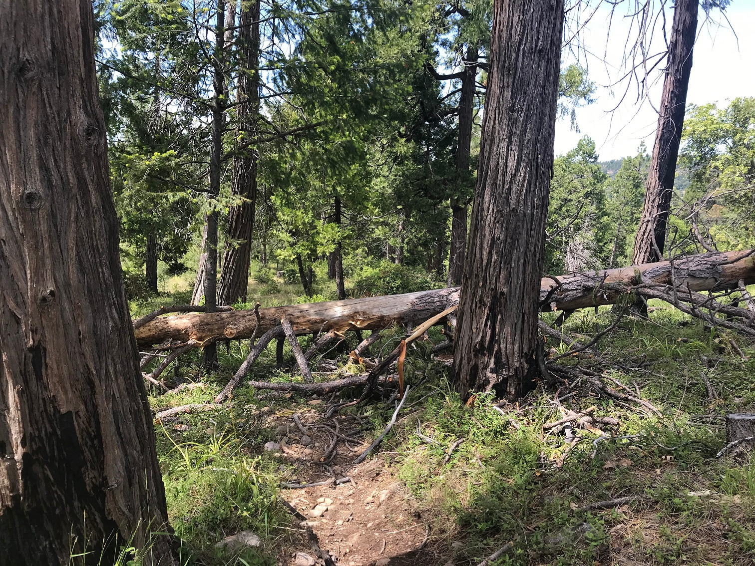
Early on in the hike, we came across a fallen tree blocking the trail. However, it is easy to go around or even over. Just watch your footing.
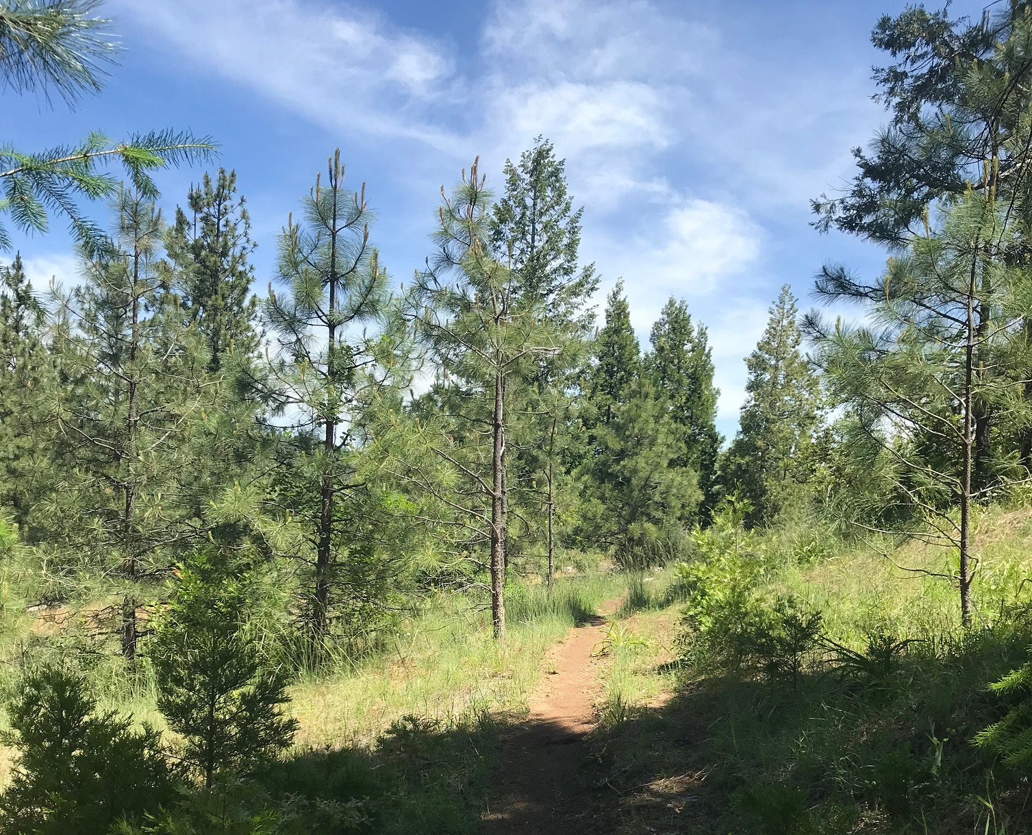
The trail will descend gradually through stands of pines and cedars.
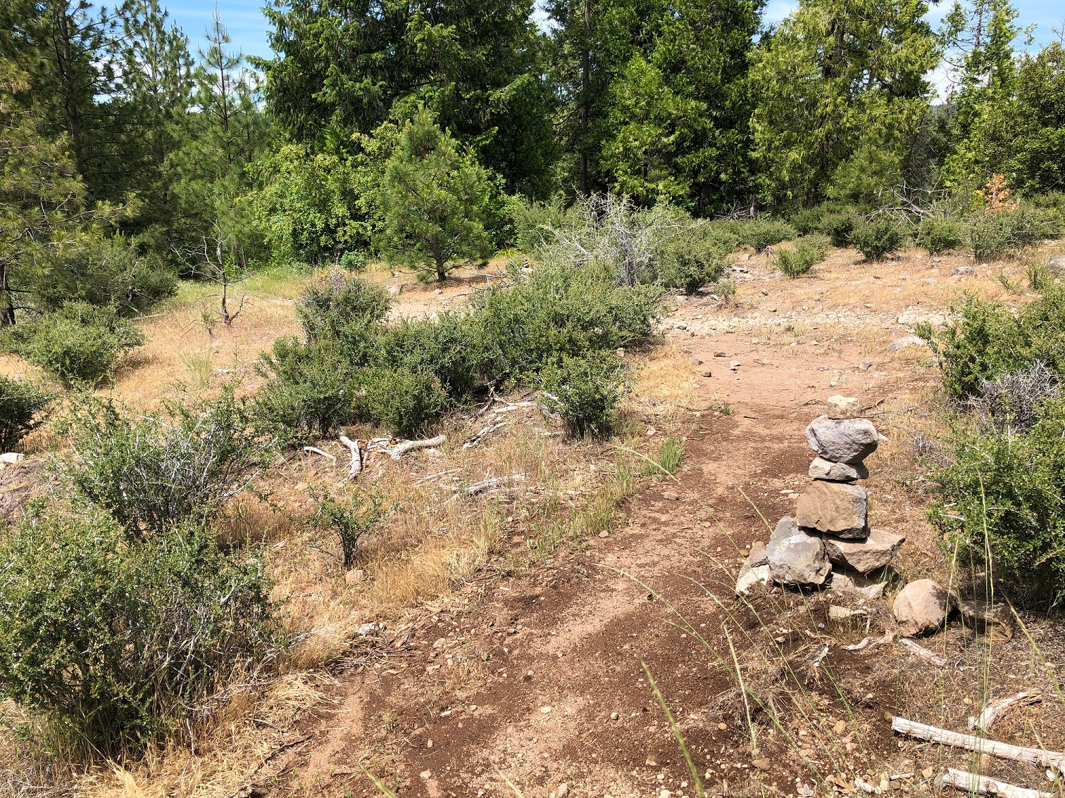
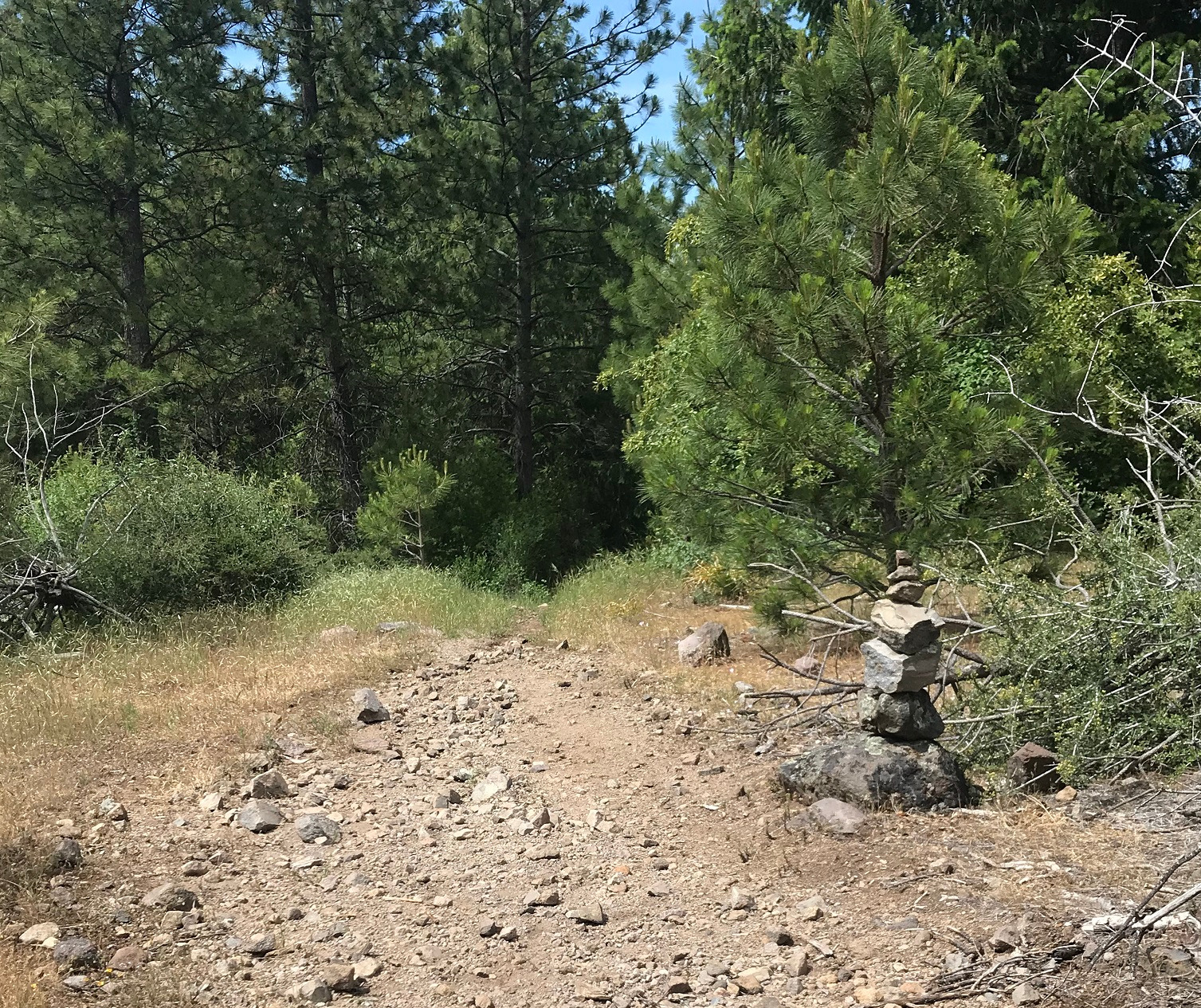
The trail is visibly marked with cairns in several places. It's important to follow these as there are no other waymarking signs along the trail:
The trail will end at a fire road, marked by a small cairn. Turn left at the fire road.
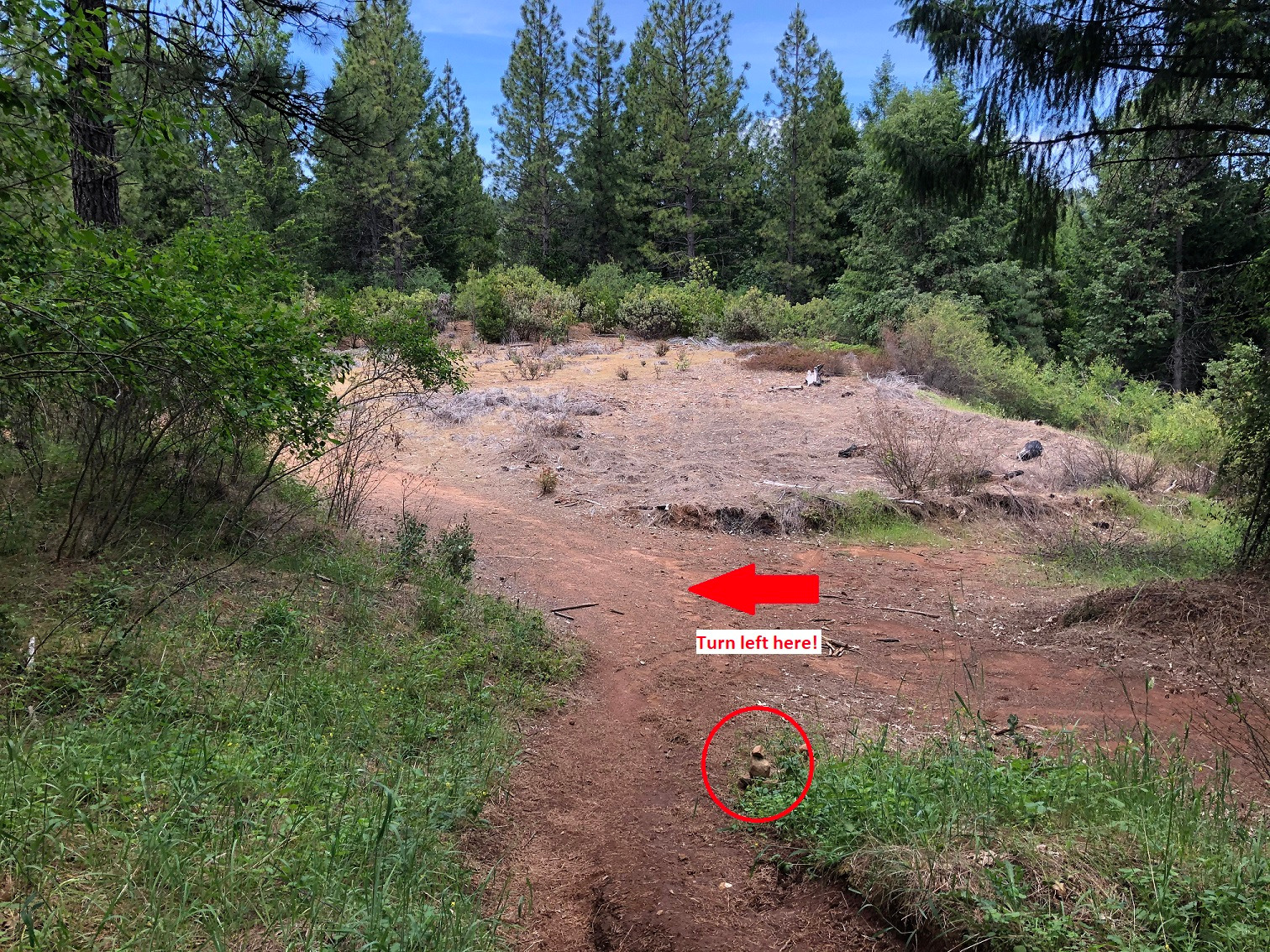
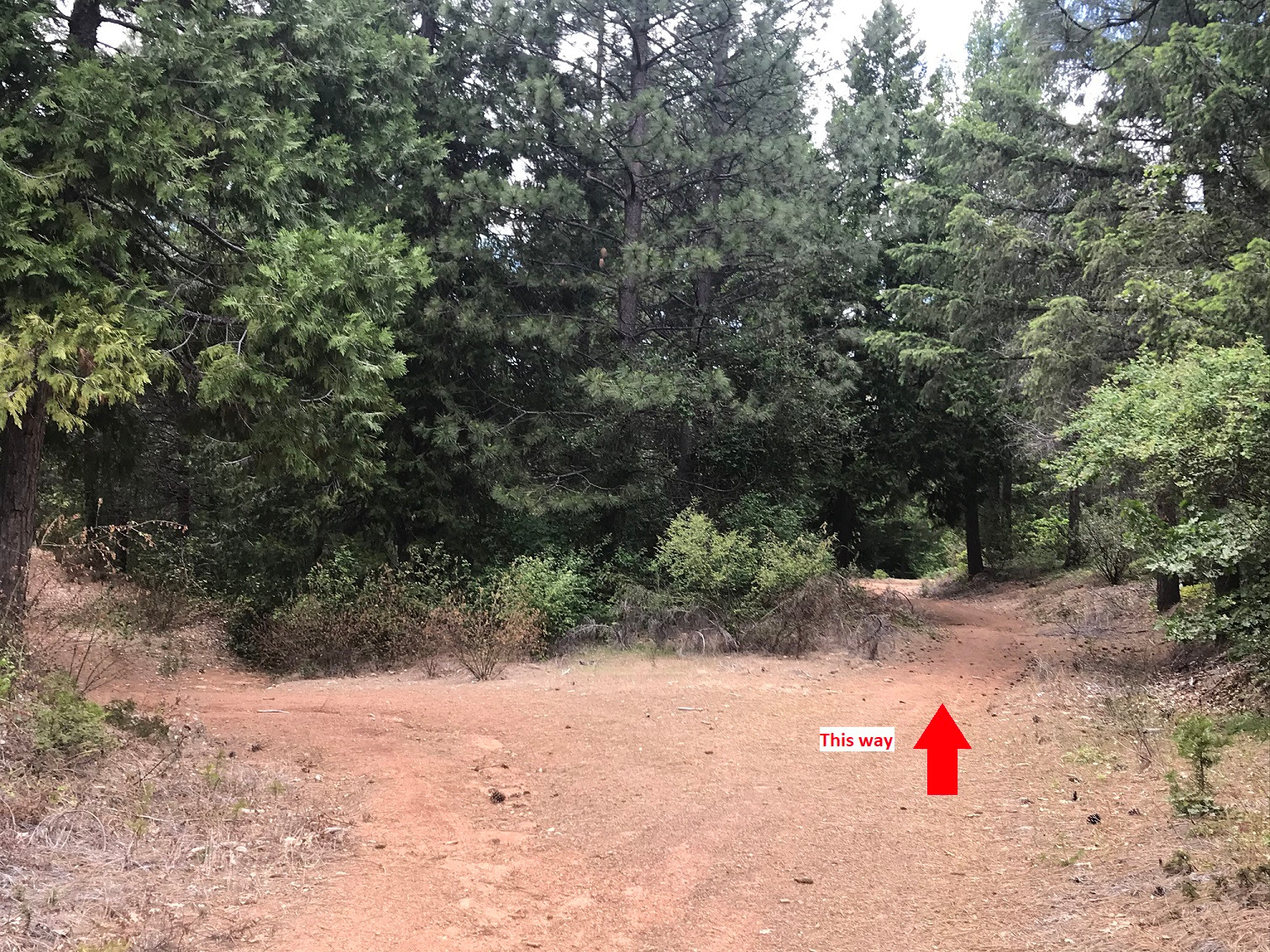
The fire road will diverge almost immediately; be sure to stay to the right.
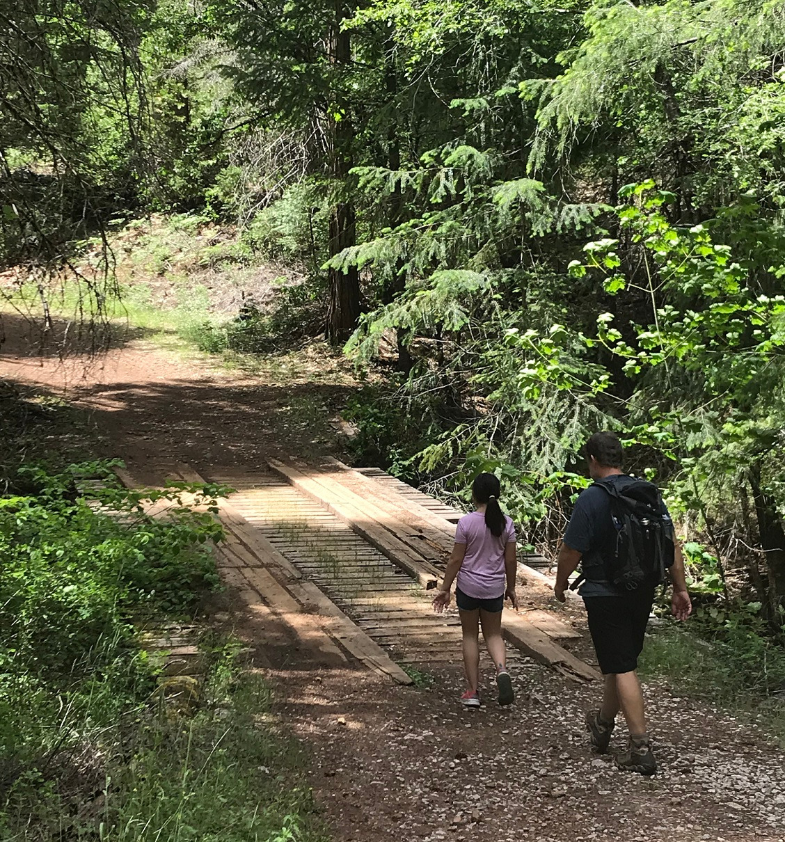
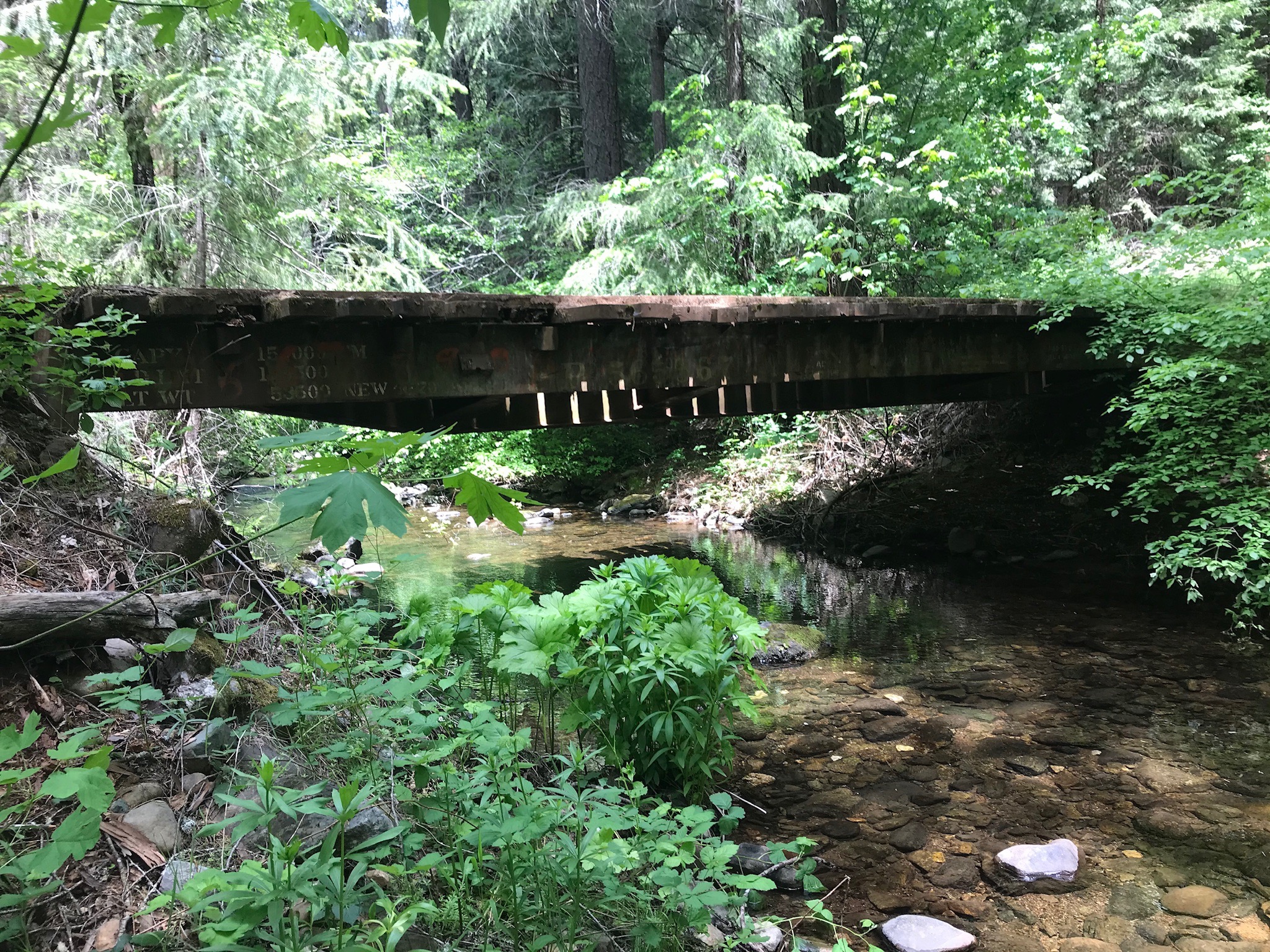
This final leg takes you down to the Consumnes river. Your destination is marked by a wooden bridge spanning the river. This is very peaceful place to enjoy your picnic!
The trail continues back up the other side of the river for some beautiful views on the far ridge. This extension adds about 4.5 miles to the trip and is the subject of Part 2 (coming soon). To return, simply retrace your steps back to the trailhead.
The AllTrails entry for this trail includes a topo map. If you are an AllTrails User, you might find that useful to have on hand as well. Happy Trails!